Overview of climate change relevant homepages
|
Links on current data and visualisations |
|
Climate, Weather and Environmental Agencies |
|
The Intergovernmental Panel on Climate Change |
|
The Intergovernmental Science-Policy Platform on |
|
The World Meteorolgical Organization (WMO) |
|
The United Nations Environment Programme |
|
. The National Oceanic and Atmospheric |
|
sos.noaa.gov/datasets/catalog/datasets/water?Display=list&ordering=-DateAdded |
|
The National Aeronautics and Space Administration (NASA) provides many data, visualisations and video clips on air, climate, hazards, water, oceans and ice etc. |
|
|
|
|
The European Environment Agency (EEA) provides detailed data and maps about the EU related to climate change: |
|
www.eea.europa.eu/data-and-maps/data/data-viewers/eea-greenhouse-gas-projections-data-viewer |
|
The Joint Research Center of the European Union provides environmental and climate change |
|
ec.europa.eu/jrc/en/science-area/environment-and-climate-change |
|
National Snow & Ice Data Center (NSIDC) provides data and visualisations on snow cover, glaciers, ice sheets, sea ice, ice shelves, soil moisture and frozen ground: |
|
The Food and Agriculture Organization of the |
|
The German Weather Service (DWD) provides |
|
The UFZ-Dürremonitor provides daily |
|
Das Hessische Landesamt für Naturschutz, Umwelt und Geologie (HLNUG) liefert umfangreiche Umwelt-Daten für Hessen: |
The Hessian State Agency for Nature Conservation, Environment and Geology (HLNUG) provides extensive environmental data for Hessen: |
|
www.hlnug.de/themen/geografische-informationssysteme/gis-anwendungen/gis-auskunftssysteme |
|
More on historical and future weather and climate data: |
https://datagraver.com/case/kyoto-cherry-blossom-full-flower-dates
|
With Earth Nullschool you can dynamically display atmospheric currents from the earth's surface to the tropopause (Jetstream). Additional data can be displayed for temperature, humidity, cloud water content, CO2 content. Sea currents can also be visualised |
|
|
|
The Fluid Earth Viewer allows current and past |
|
The goal of the Climate Reanalyzer is to make key climate information – models and station data – readily available to everyone. |
|
At Sea Temperature.org you get the current and |
|
The Terrestrial Precipitation Analysis Packages |
|
drought-net.colostate.edu/terrestrial-precipitation-analysis-package |
|
The Global Terrestrial Network for Permafrost |
|
|
|
WorldClim provides historic, recent and future |
How do climate models work?
https://www.carbonbrief.org/qa-how-do-climate-models-work
|
More on historical and future Greenhouse |
|
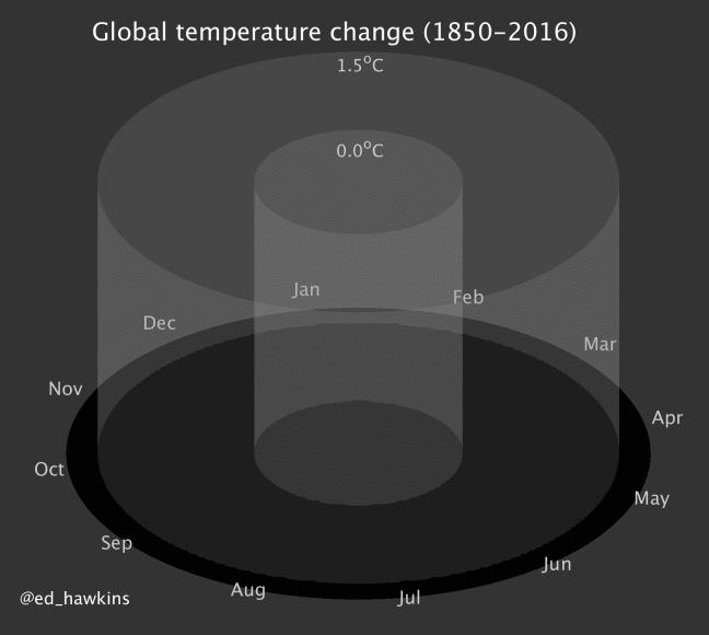
Climate Spirals and Tornados are impressive |
|
www.usgs.gov/media/images/simulated-global-temperature-change-0 |
|
openclimatedata.net/climate-spirals/from-emissions-to-global-warming-line-chart/ |
|
The Global Carbon Project integrates knowledge of greenhouse gases for human activities and the |
|
https://www.globalcarbonproject.org/carbonbudget/19/visualisations.htm |
|
The Atmosphere Monitoring Service of Copernicus displays actual emissions of and CH4 and other pollutants |
|
|
|
Puls provides a global methane emission |
|
Climate Watch offers open data, visualizations and analysis to help policymakers, researchers and other stakeholders gather insights on countries' climate progress: |
|
The Climate Action Tracker is an independent |
|
The Production Gap Report measures the gap |
|
The Greenhouse Gas Management Institute involves educating on the basics of GHG accounting, auditing and management, training professionals to meet the |
|
Open Climate Data provides data resources on Global carbon cycle and emissions data, including fossil-fuel, cement, and land-use change emissions, atmospheric growth, and ocean and land sinks. It also gives access agreement status and National Climate Plans: |
|
On Our World in Data.org you can find data on |
|
Worldometer is run by an international team of |
|
Fire Monitoring and Ecosystem and Biodiversity Loss |
|
|
Fire Information for Resource Management System (FIRMS) provides satellite global data on fire events: |
|
firms.modaps.eosdis.nasa.gov/map/#t:adv;d:2019-08-23..2019-08-24;l:viirs,modis_a,modis_t;@0.0,0.0,3z |
|
The Amazon Dashboard tracks individual fires in the Amazon region using a new approach to cluster and classify active fire detections by fire type: |
|
Global Forest Watch offers the latest data, |
|
Global Forest Change results from time-series |
|
Global Soil Biodiversity Initiative is seeking to |
|
Global Soil Partnership and Intergovernmental Technical Panel on Soils (ITPS) addressing sustainable soil management in the different sustainable development agendas |
|
|
|
|
|
|
|
|
|
|
|
Audubon Society - Survival by Degree shows for North American bird species how the range is expected to change under different climate scenarios. |
|
|
|
|
Potential Strategies and Solutions for global change mitigation and adaptations |
https://unfccc.int/climate-action/marrakech-partnership/reporting-and-tracking
|
The World Resource Institute (WRI) focuses on |
|
Resource Watch provides trusted and timely data for a sustainable future: |
|
The Global Safety Net developed the first global- |
|
The Crowther Lab Restoration app wants to connect ecological science with applied ecosystem restoration: |
|
The Alliance for Zero Extinction (AZE) engages governments, multilateral institutions and non-governmental biodiversity conservation organizations (see list of AZE members) working to prevent species extinctions: |
|
www.arcgis.com/home/webmap/viewer.html?webmap=4ecca6a29bf142338e459e27ade152c8 |
|
Interactive stories about the climate crisis |
|
CNN offers elaborately designed and interactive press features on climate change, climate feedbacks and deforestation. |
|
https://edition.cnn.com/interactive/2020/12/world/ticking-time-bomb/ |
|
https://edition.cnn.com/interactive/2019/11/asia/borneo-climate-bomb-intl-hnk/ |
|
Spiegel Online creates a multimedia series on |