Mapping Land Degradation in Drylands from Space

Monitoring Sustainable Development Goals from Space
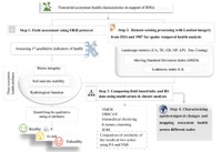
A recent study led by M. Sc. Mojdeh Safaei and co-authored by Dr. André Große-Stoltenberg and Prof. Dr. Till Kleinebecker shows how satellite data can contribute to map degradation of drylands. The study illustrates the potential of remote sensing for monitoring Sustainable Development Goals such as SDG15 "Life on Land" and "Land Degradation Neutrality".
The study was published in the journal Landscape Ecology and is freely available under the following link: https://rdcu.be/cOp2u
